Actually, there is. Mount Toubkal was high enough for us and we'll stop there.
We love what Morocco has to offer in terms of parks and outdoor adventure. Here in Rabat, we have no shortage of paths to run on and parks to run in. We can go surfing in the morning and kayaking in the evening. If we want to compete, there is no shortage of races to participate in. And with the Atlas Mountain chain, you can also get in some excellent hiking in the summer, or skiing in the winter. Being active people, we wanted to take in as much of Morocco's sport culture (outside of soccer) that we could.
Since arriving in September, we have participated in five 10k races, one half marathon, one full marathon, and one 20k trail race.
Last month we traveled to Imlil, where we hiked the Atlas Mountains and summited Mount Toubkal, the highest mountain in all of Morocco, North Africa, and the Arab World (13,671 feet). In just a few weeks, we will attempt the Trail des Cedars trail race in Ifrane. This is a 3-day race, where we will hopefully complete 34k, 26k, then 22k...we'll keep ya posted on that one.
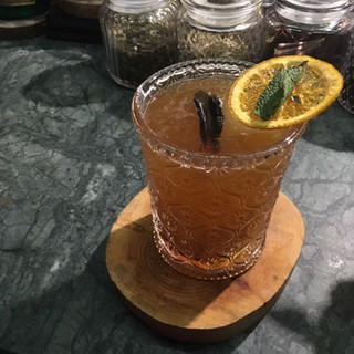
But this post is about our Mount Toubkal summit trek. We utilized a company that was recommended to us by the Embassy, Toubkal Trekking. We used this company once before for our day-trip to Essaouira back in January. Their prices are a bit more expensive, but we've enjoyed two wonderful trips with them now and feel it is worth it for the peace of mind. They maintain good communication with us prior to the trip, their transport is new and comfortable, the drivers/guides have all been very good, and we never have to worry about anything with them. **Side note: We stayed in Marrakech the night before and the night after the trek. We want to give a shout-out to our dear friend, Karen, for sending us this NYTimes article back in October, because we finally made it to Barometre for pre-hike cocktails and it was such a cool place!**
Our driver picked us up from our hotel in Marrakech at 0830 on a Friday morning and drove us the 1.5 hours from Marrakech to the town of Imlil. If you're wondering where you may have heard of Imlil, yes, this is the same place the two European hikers were horrifically killed back in December. It is important to note that since the tragic event, it is mandatory that all persons entering the trail have a certified guide with them. There are also two/three police checkpoints along the trail. To get from Imlil to the Toubkal summit, there is only one path. During our trek, we saw at least 50 other people out on the trail, and we never felt anything but safe. Because we've had a few people ask, Moroccans were just as outraged by this event as everyone else because it perpetuates an unsafe image of Morocco, when the reality is that it is quite safe.
Upon arriving in Imlil, we met our guide, Mohammed, and loaded our overnight bags onto a mule (which would follow us to the Toubkal Refuge at the base of the mountain). Even though this is what the mule was bred to do, we felt bad for the little guy and were thankful that we only had two small backpacks (filled mostly with a sleeping bag), and that the mule guide did not ride the mule. We saw other mules on the trail who were carrying pretty heavy loads in addition to an adult male. J also made sure to bring our little workhorse an apple as a gift (which he devoured). And so the trek began!

The hike from Imlil to the Toubkal Refuge was approximately 8.5 miles and took about 4.5 hours. The elevation change for the first segment was approximately 5,000 feet and we ended the day at 10,500 feet. Let us just say...as two very athletic people who just ran a marathon...walking up a mountain when you've been at sea level for basically your entire life is no joke. Little did we know, that was nothing compared to what we would experience the following morning! We made it to the refuge, which is a pretty incredible compound. Considering the only way to get materials 8.5 miles into the mountains is via mule, the fact that there are two large buildings, complete with kitchens, bathrooms, running water, and hot showers, is mind boggling. We spent the rest of the afternoon relaxing and enjoying the scenery. After dinner, we tried to get to sleep early since we would begin our trek to the summit in the dark hours of the morning.

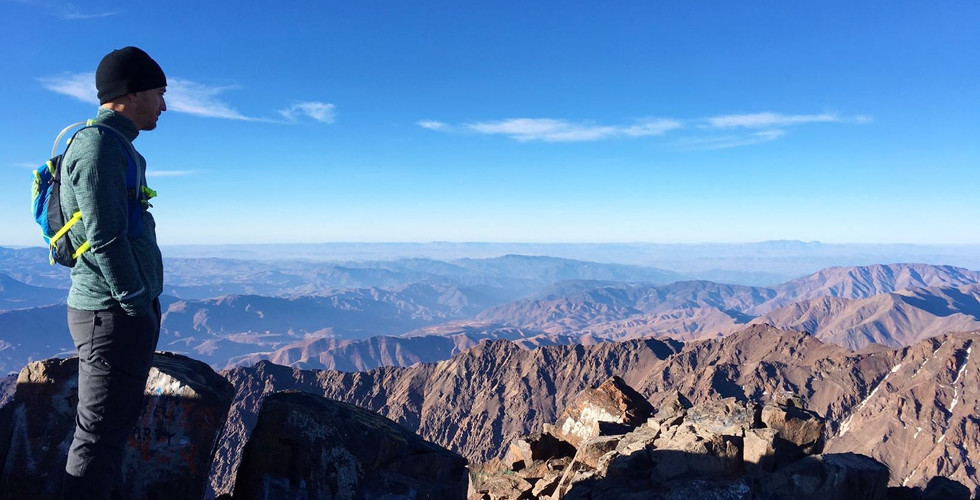
We were out the door and into the darkness at 0430 the following morning, the third group on the trail. With slightly warmer gear and headlamps, we began the steep and challenging climb to the summit of Mount Toubkal. The distance was only about 2.5 miles (5 miles round trip), but takes about 4-5 hours to complete because the terrain is quite difficult. The first half of the route is climbing up large rocks, and the second half is all loose scree. Add to that the increase in elevation from 10,500 feet to 13,500 feet and you quickly understand why it takes so long. We found ourselves gasping for air every few steps. Such a strange feeling! But as soon as you stop to rest, your heart rate returns to normal and you feel good. Only to be reminded in ten steps that you are winded, yet again. Regardless, our guide was haulin' it up that mountain and we had long surpassed all the other groups and managed to complete the first half of the trek in 40 minutes (he said it takes most people one hour). At this point, the sun had started to rise and our guide proposed to us two options: take the "normal route" or take the "shortcut". The normal route was cleaner, but longer. The shortcut was shorter, but basically a scramble straight up the mountain face with no clear path. What the heck, if we were gonna get this far, we weren't going to settle for the easy way up. Even though we may have had to stop climbing to catch our breath every 2 minutes, we made it!
It was significantly colder and windier at the summit, so we quickly took some photos and started the scramble back down the mountain. We did not take the shortcut back down, but we were glad we took it going up because the traditional route was extremely windy and much colder. We pretty much skidded/slid our way down the loose rocks, making it back to the refuge in record time (according to the other guides). Having oxygen on our side was also helpful :) After a quick re-group at the refuge, we started the long haul back to Imlil. The distance covered on day two was 14.5 miles. Once we arrived to the staging area in Imlil, we enjoyed a delicious meatball tagine before heading back to Marrakech to shower and relax for the remainder of the day. We were beat!
Overall, super cool (and challenging) experience...and that includes the whole "not being able to breathe" thing, as well as the second-day soreness associated with using ankle stabilizing muscles that you didn't know existed. We'll leave you with some more photos of the gorgeous Atlas Mountain scenery.


